ST-Links SpatialKit versions

It is an ArcMap Extension for directly connecting to spatial databases
4.0
Feb 23, 2013
Review
3.0
Oct 25, 2011
Review

Alternative downloads

gvSIG desktop
gvSIG desktop
Free
rating

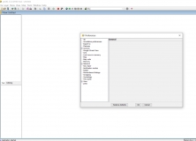
Analyze, save, and process various geographic data.

ArcMap 3D Viewer
ArcMap 3D Viewer
Free
rating

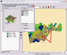
Command for ArcMap to visualize ArcMap layers in 3D.

Geospatial Modelling Environment
Free
rating

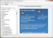
A platform designed to facilitate rigorous spatial analysis and modelling.

Attribute Extractor
Attribute Extractor
rating

Helps you batch extract attribute data from AutoCAD attribute blocks.

Spatial Manager for AutoCAD
rating

It is an AutoCAD plug-in that allows you to import and manage spatial data.